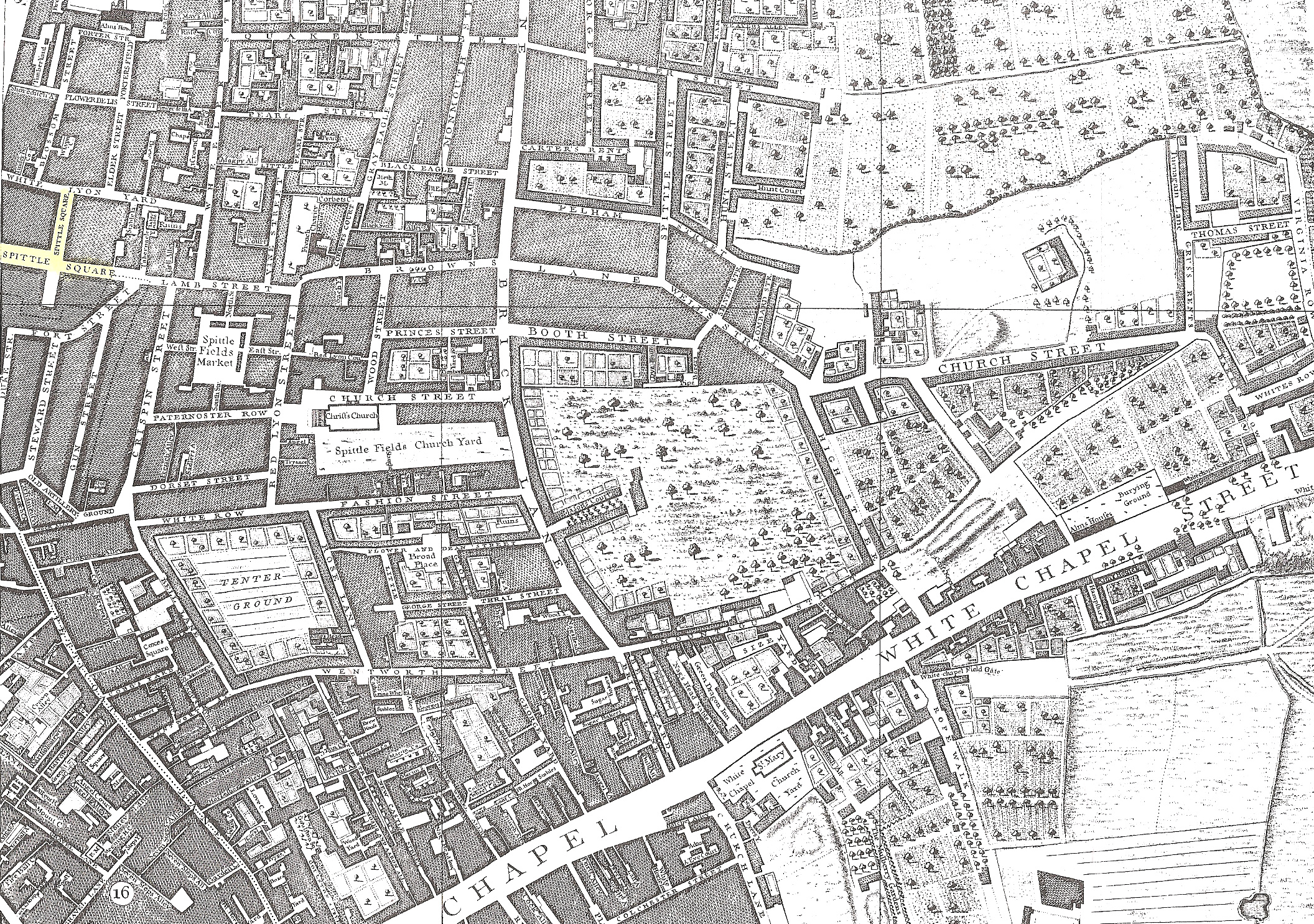
In this late 1700's map we see Tenter Ground. This is
where woven silk was stretched out on tenterhooks. This where we get the phrase
'being on tenterhooks' - being stretched in anticipation. The word tent of
course, implies cloth over supports.
Spital Square is towards the top left of this map.
Spitalfields lies outside of the old walls of the City of London on the east
side of the Roman Ermine Street (now Bishopsgate Street.) This road ran from the
Port of London on the Thames, to Lincoln and York. Spital Square is very close
to Bishopsgate Street, thus useful for travel and really close to the City of
London where the Banking quarter is. We know that the de Brissac family had
banking connections from their time in Utrecht. Threadneedle Street (now
London’s banking quarter) is within easy walking distance and was also a family
home address. (Less of a mile west of this map)
Back